-
01725 552211
Flood Management
This page and its sub pages outline the Parish Council Flood Management Plan and asscoiated historical information.
Emergency Plan, Flood Warden, Flooding
OgImage:
Flooding and its effects on the Parish
This
page provides information about the risk of Flooding in the Parish as
covered in the Emergency Response Plan and additionally gives an
Environment Agency description of what Groundwater flooding is and how
it is the cause of flooding within the parish. The page is also to
provide a view of documented information about flooding in the parish in
recent years to ensure actual events are not lost and going forwards we
as a parish can take action to minimse the flood risk. Each subsequent
flood event will be captured on this page. Regardless of this activity
individuals affected by a flood event should report it using the Flood
Online Reporting Tool (FORT) - Here. Using this tool
does not impact insurance policies but allows the Environment Agency to
identify trends and set strategies for dealing with these events with a
view to gaining funding to support implementing the strategies. This
action resulted in funds beinig provided to parishioners following the
2014 flooding to improve flood protection. At the end of the page are useful liinks to further information
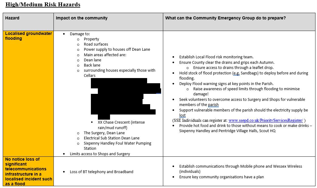
What is the Flood Management Plan
This plan addresses specific events int the Community Risk Register listed below, Note the areas blacked out are addressed identified for support recorded in the actual plan.
|
What is the risk of Flooding
The following is an extract from an Environment Agency Report on Groundwater Flooding, explaining what it is and its effects on Sixpenny Handley.
Groundwater Flood risk maps for Chalk catchments
The current national maps for groundwater flood risk are commercial products and not freely available. This also means evidence is not accessible for a robust appraisal of the methods used, and therefore it is difficult to make a detailed, accurate assessment of their suitability and accuracy. In general, they are derived from modelling which predicts the distance of the water table from the surface under peak winter conditions. They do not, as a rule, indicate emergence zones which occur because of the local geology, hydrogeology, hydrological conditions and manmade factors such as the built environment.
Key drivers of groundwater flooding on the Chalk
The Chalk has a dual porosity. This means that water is transmitted quite freely through fractures in the rock between the surface and the saturated zone and then can be stored within the minute intergranular spaces – at up to 40% by volume. The small pore space between grains of Chalk mean that water can only be released quite slowly – leading to long duration bouts of flooding. Conditions that lead to groundwater flooding include:
- An accumulation of above average winter rainfall,
- Hydrostatic pressure – the water table can be several tens of metres higher than at risk communities, forcing water up through emergence zones,
- Capillary action – water is drawn up from the aquifer by a wicking effect, meaning that flooding can continue for weeks after a period of heavy rainfall.
- Proximity to natural or manmade emergence zones.
Importance of identifying emergence zones
As the water table approaches the surface, flooding occurs at points of weakness – following the line of least resistance. Examples of emergence zones include:
- periglacial valley gravel deposits,
- proximity to the bed of ephemeral streams or winterbournes
- fault lines,
- the boundaries between rock strata,
- bands of hard rock within the Chalk, which are prone to more intense fracturing,
- areas in proximity to the downslope of clay caps where acidic rainfall causes enlargement of existing fractures through dissolution of the Chalk,
- areas where human intervention has caused disturbance to natural flow paths within the rock,
- communities at the foot of the scarp slope, along spring lines,
- sink holes, often appearing as shallow depressions in the surface.
- When considering any development on the Chalk, planners and developers should take account of the above factors.
Impracticalities of conventional surface water management schemes
Drainage on the Chalk is usually in a vertical rather than horizontal plane. Once the local water table reaches the surface, drainage reverts to the horizontal. Local drainage networks rarely have the capacity to manage under these circumstances.
- Traditional attenuation ponds are ineffective as they fill from the bottom up and remain full until groundwater levels start to fall back. They can contribute to groundwater flooding by opening a pathway to the surface.
- Land drainage measures such as French drains and porous pipes can be effective at preventing flooding to existing properties by creating a very localised cone of depression in the water table. However, water that is drained away is immediately replaced from the aquifer – effectively by abstraction. This water will eventually contribute to river flows, with an increased fluvial flood risk downstream.
Impact of human interference in groundwater flow paths
There are several ways that groundworks associated with construction can contribute to groundwater flooding.
- Footings may redirect subterranean flow paths, leading to emergence in places that were previously dry,
- Groundwork can open fractures, leading to augmented emergence at the site e.g. through piling,
- Culverts can create a linear barrier to underground flow. This may lead to water weiring over the structure and breaking through to the surface or creating a drainage path alongside the culvert leading to erosion along its length.
- Depending on the structure of the regolith, removal of putty Chalk material, for example, can change hydrogeological emergence characteristics locally.
- Groundwater flows beneath the surface, through the valley gravel deposits. Construction of barriers (footings etc.) across the flow path commonly causes water to rise to the surface.
Impact of groundwater intrusion into foul sewage systems
Whilst the impact of groundwater intrusion into the foul sewage system is unlikely to be directly worsened by new development where work has been undertaken to seal the sewage network, any additional input will cause problems where the network is struggling with capacity. Where tankering away occurs, this can lead to additional heavy traffic along flooded roads.
Impact of traffic
Historically, periglacial valley gravel deposits which cover the bed of dry ‘winterbourne’ valleys made ideal roads. During high groundwater conditions, these roads once more become rivers, often for several weeks at a time. At a time when traffic was pedestrian or horse drawn, the impact on adjacent properties was minimal. However, the bow wave created by modern vehicles significantly increases the risk, with exposure to continuous spray penetrating the fabric of buildings.
With increased flow, roads will become impassable for longer periods. Not only does this lead to more disruption but also carries the cost of damage to vehicles.
Increased ‘downstream’ risk
Several factors can increase the flood risk to properties downstream of any development.
- Inappropriate surface water management schemes (as above) can contribute additional flow to existing watercourses,
- Contribution to sewage systems being overwhelmed, leading to effluent backing up into downstream properties,
- Increased access problems as highways become inundated for longer periods,
- Increased contribution to fluvial flood risk.
Possible mitigation measures
Several groundwater control strategies can be used, including open pumping, pre-drainage pumping, shallow and deep cut-off walls and ground treatment. The strategy appropriate to a given site must be selected based on a thorough understanding of the hydrogeological setting and chalk weathering profile. This requires a ground investigation of appropriate scope, using suitable techniques to characterise the chalk. Borehole geophysics can play a key role in identifying discrete zones of inflow. Disposal of any produced water both during construction and thereafter must be accounted for.
Climate change
The impact of climate change on groundwater flooding on the Chalk in southern England is not completely understood, however research undertaken by the British Geological Survey (BGS) on behalf of the Environment Agency’s Water Resource function (National groundwater recharge assessment under climate change) states that:
Modelling shows that the re-charge season will be shorter, but with significantly higher rainfall totals in the winter. This is likely to increase both the impact and frequency of groundwater flood events.
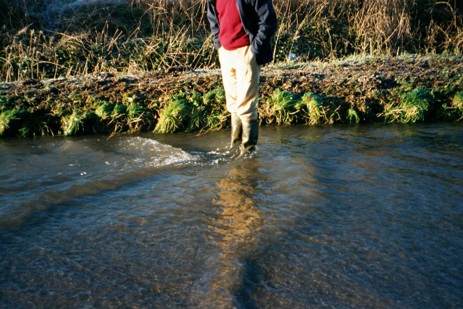
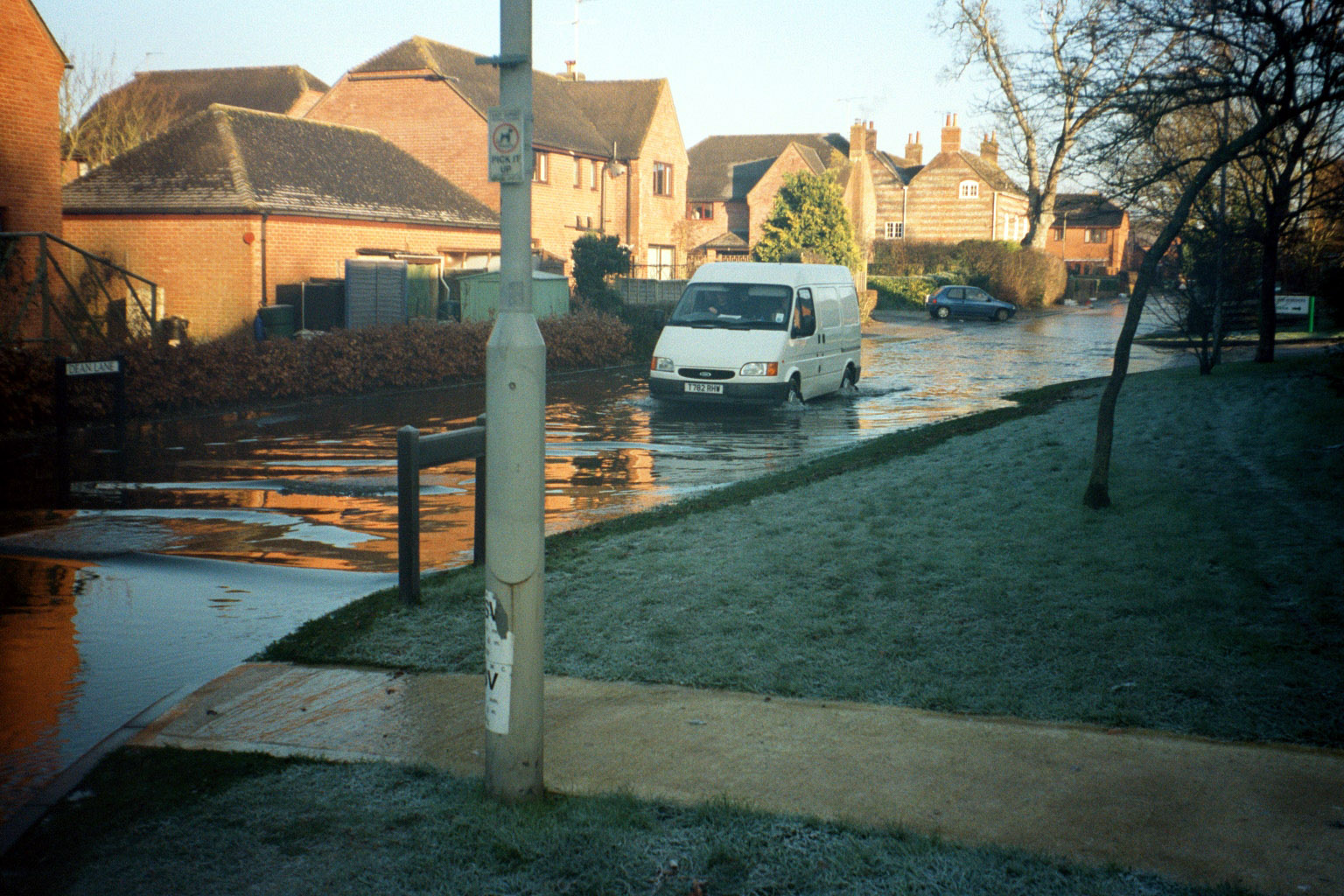
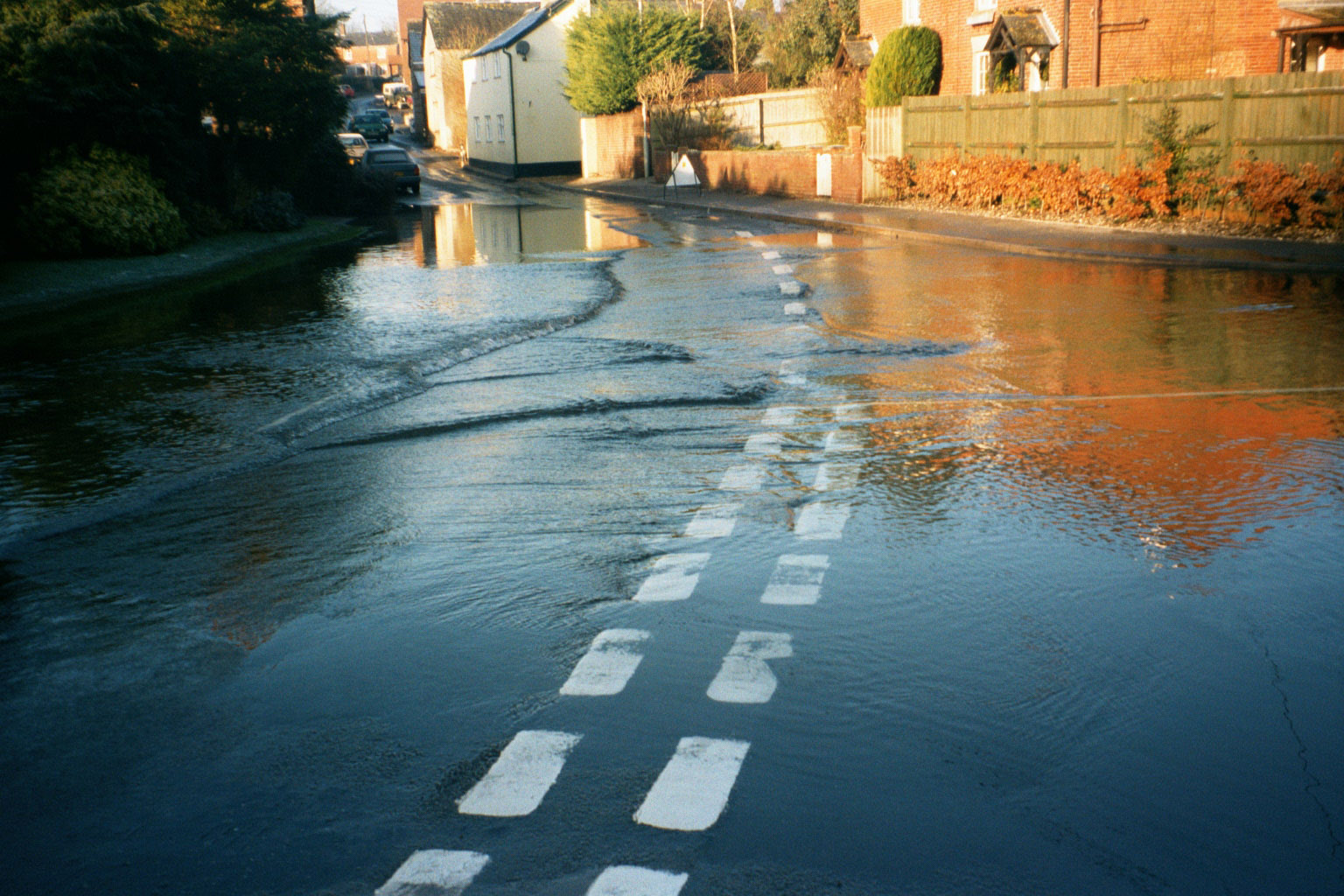
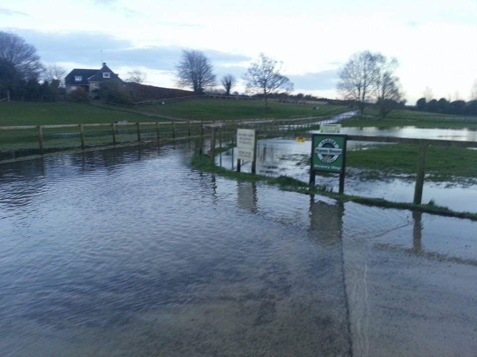
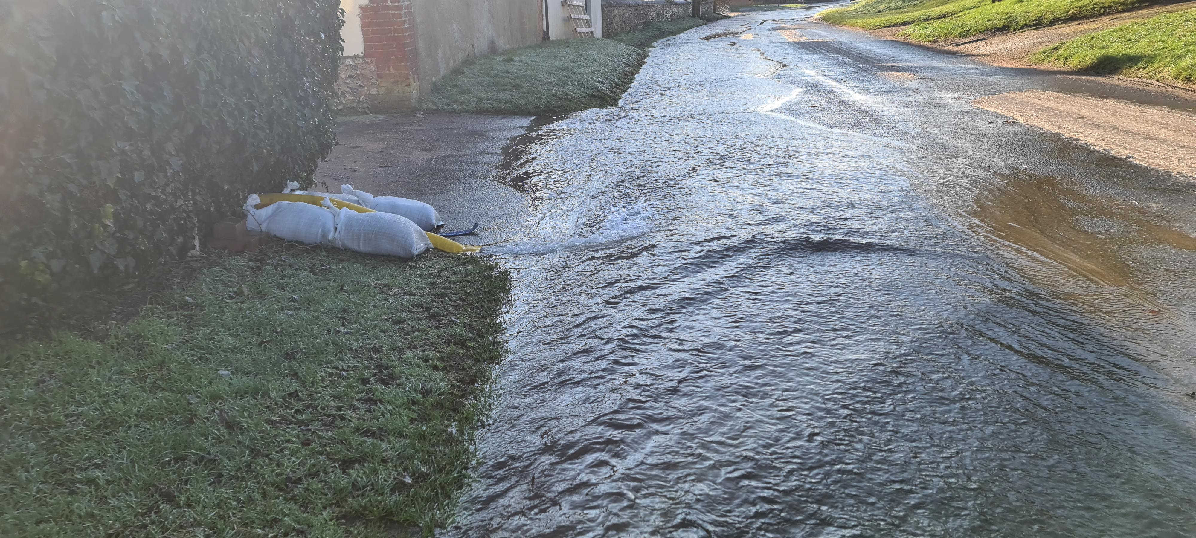
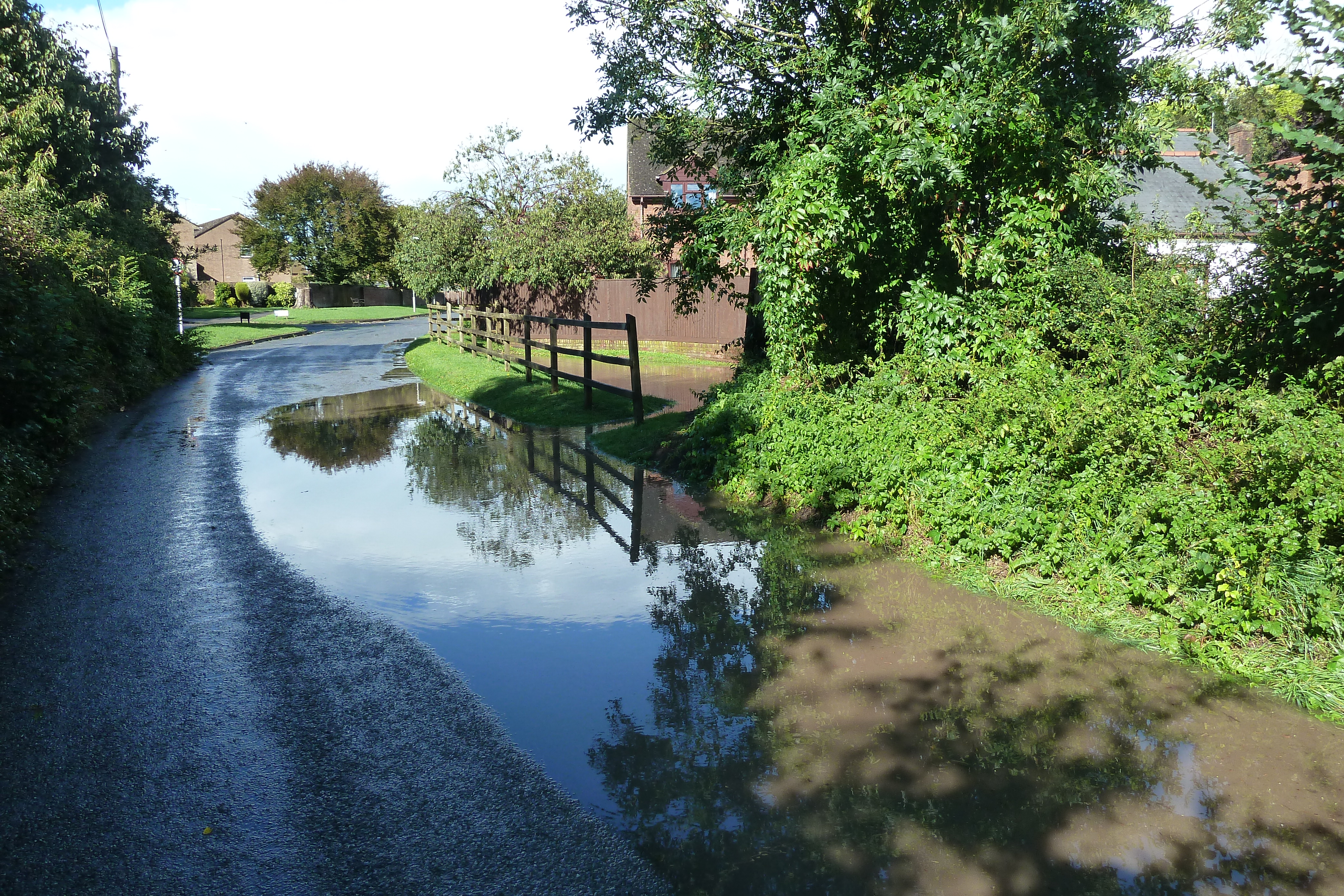
Flooding to a depth of 200mm from a groundwater source runs from Garston Wood to Back Lane via Dean Lane & Frogmore Lane. Flooding of this type is known to have occurred on seven occasions since 1990. Records of property flooding in Sixpenny Handley include flooding to 5 properties in Dean Lane (‘95, ‘01, ‘03, ‘12,’14,’20, ‘23), 1 in Frogmore Lane (‘13 &’14) and 1 at Manor Farm (‘03 & ‘14) (Flooded property history from Dorset Council – FORT. Data prior to 2014 is limited).
Sixpenny Handley
Water flows down the road into the village from Garston Wood into Dean Lane across the bottom of the High Street into Frogmore Lane, into the adjacent field via a culvert and out of the village along back lane and the culvert in front of Manor Farm where it then feeds out into the fields down to Endless Pit. As stated above this is an ancient gravel bed and the junction of two types of Chalk bedrock. This combination leads to mulitple groundwater outlets which overload the road drainage system as are the Grips and Gullies along these roads.
Pentridge
The stream running through the village can flood due to the volume of water flowing down through the culverts, this causes the water to overflow and run down the road. This can also be cause by debrie blocking the culverts.
Minchington
The stream running from Farnham down through Minchington to the A354 floods from the ford downstream. This limits access and can prevent refuse vehichles from collecting from houses in this area due to the depth of water, especially at the crossroads.
How do we address Flood Risks
The following tasks and activites are initiated through this plan
- Registration with the EA Alert system by individuals and Emergency Planning Officer. Alerts re issued when the Woodyates Borehole rises to XXM. Flooding is expected when this rises to 105M.
- We are Identified as a Sandbag Store with 1 ton of Sand and 2000 sandbags in dry storage at Manor Farm (outside of the flood risk area). These are deployed into the Town Farm Workshops when the likelihood of flooding is identified. Impacted homeowners are notified. The status of the store is confirmed by Dorset Council every year through the Emergency Planning Officer.
- Emergency Planning Office monitors the Borehole at least every 48 hours to establish the speed the water level is rising.
- EA Alert system issued when 105M is reached
- Email alert to identified parishioners, typically those who could be affected by the floods when the EA Alert system triggers
- Individuals take action with thier own Flood Protection in line with the EA alerts and Flood Warden emails. This will extend to obtaining sandbags from our store.
- Properties effected by sewage backup should report any occurance to Wessex Water and on the FORT tool (see useful links below)
- Facebook and NextDoor app messages initiated when the likelihood of flood is going to occur, updates to this are in line with how the floods and impacts progress.
- Flood Warning signs deployed around the crossroads, Dean Lane and Back Lane by the Emergency Flood warden
- Interact with Dorset Council Highways as necessary throughout the floods, this maybe to request additonal signage and/or support.
- Vehicles should drive slowly through the floods to prevent bow waves that will cause damage to properties alongside the road and/or splash pedestrians.
- Members of the publich affected by motorist 'spalshing' pedestrians when driving through the floods should report them via 101 as this is an offence under the road traffic act. - The Parish Council will notifiy the public that this is an offence and should be reported.
What have we done in the past
The following sub sections identify the actual flood impact for each time the Parish has been affected by flooding from information captured withiin the community. They indicate the scope and period the flooding occured and how the parish was impacted along with supporting photographs.
If anyone has additonal information on a flood, please make it available to the Parish Clerk for inclusion in this page to ensure a full and accurate record of the floods is maintained.
2003 Key Aspects
- Duration and Impact of flooding on the Parish during the flooding
The floods occurred at the end of April and ran springs starting at Garston wood, down through the village with water running on the in Dean lane as well as through the drains. This water ran into the Paddock next to Frogmore Lane and into Back Lane. As was the norm, all gulleys filled with this water and culminated in water backing up and pooling on Back lane just past Red Lane until it eventually drained away
- Impact on Infrastructure post the flooding
Dean Lane, Frogmore Lane and Back lane flooded and there was water running across the cross roads where Dean Lane and Frogmore Lane intersect the B3081.
- Photographs taken during the floods
Flooding at Back Lane
 at 6dH.jpg)
|  at 6dH.jpg)
| 
|
Flooding in Dean Lane
| 
|
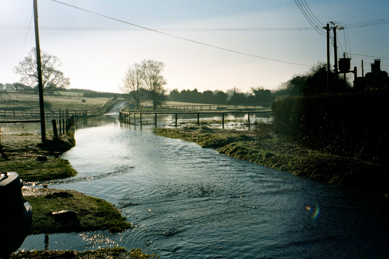
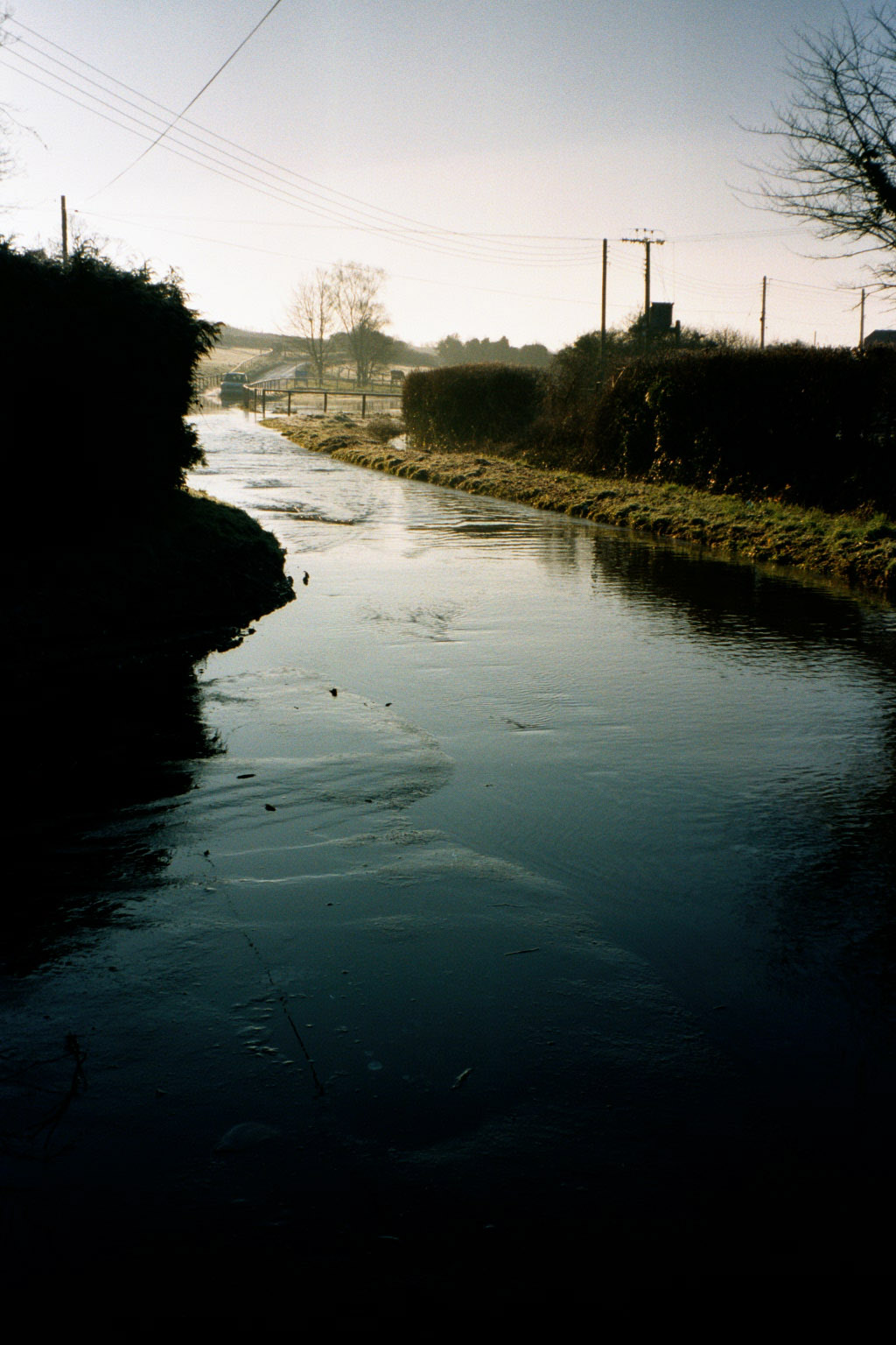
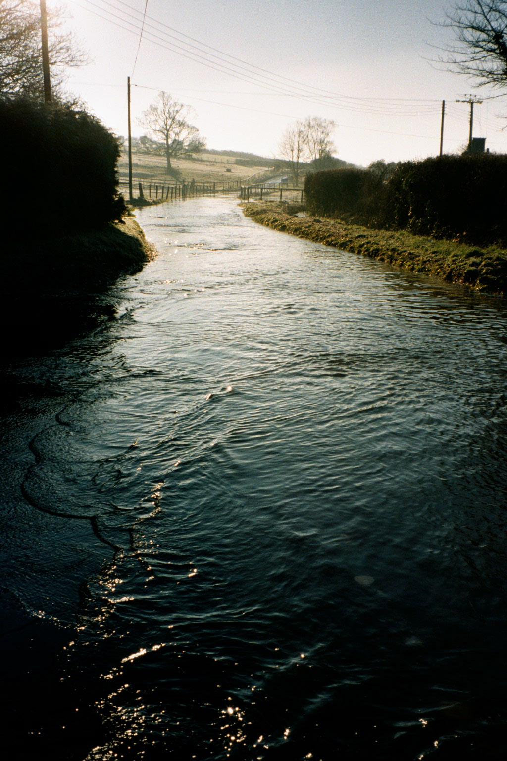
Flooding along in Back Lane towards Manor Farm running from Frogmore Lane and the Paddock
| 
| 
|
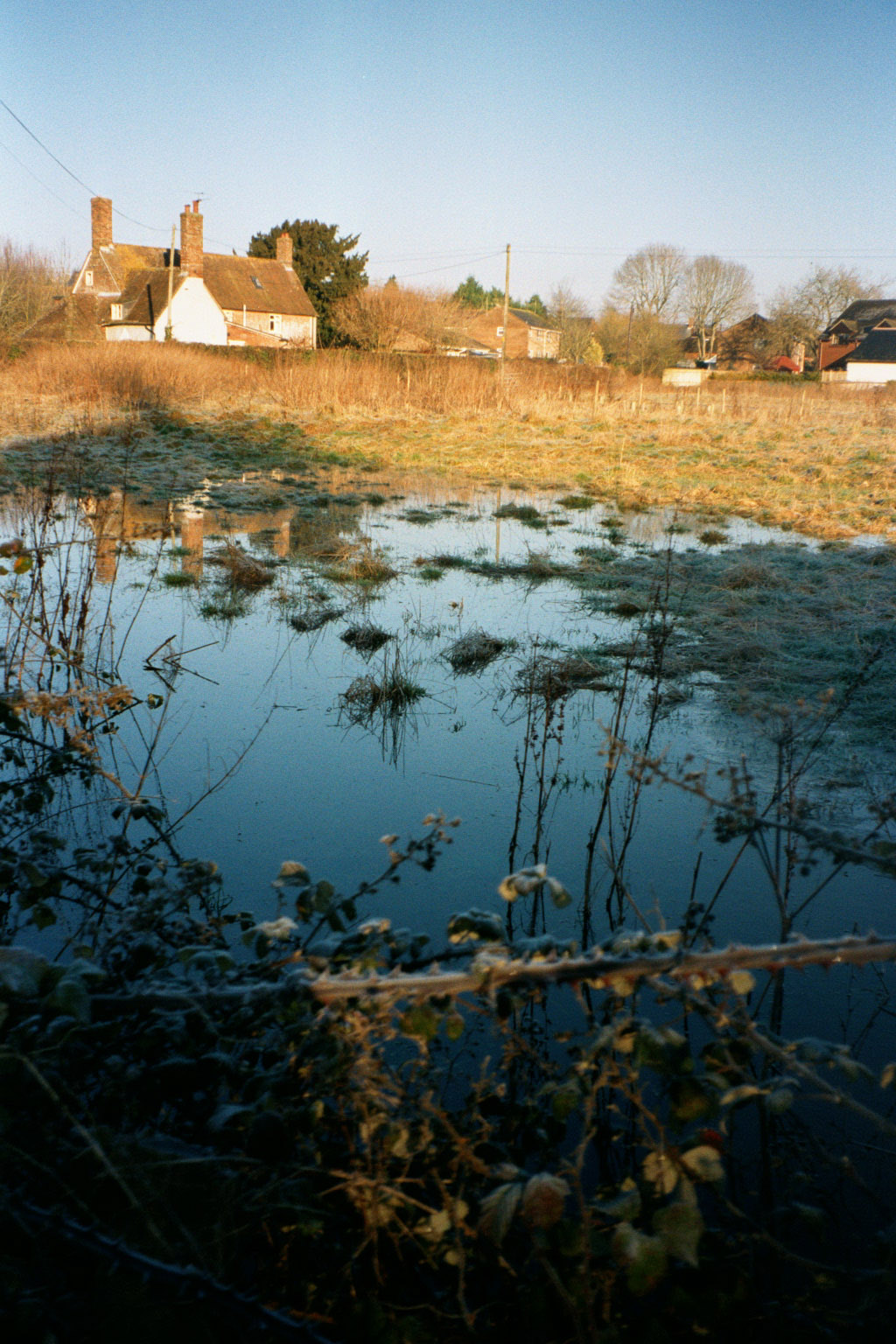
The Groundwater flooding running down Dean Lane and its drains discharge into the remains of Frogmore Pond where they pass through the Paddock adjacent to Frogmore Lane. The photos below show the extend of flooding in that field at the time of these floods. It is known by locals as a flood catchment area when we have extensive flooding. Horse owners who rented this field could not have their horses in this field due to the flooding each winter as they were ankle deep in water.
 at 6d.jpg)
| 
|
2014 Key Aspects
- Duration and the impact of flooding on the Parish during the flooding
These
floods lasted for around 4 weeks during which time there was
significant damage to the roads from Garston Wood down into Back Lane
with the latter requiring significant resurfacing. During the period
there were also power outages to a number of properties due to water
affecting the underground cables. However power was restored within a
reasonable timescale. Whilst having both pumps and sandbag protection a
number of properties were impacted and reported via the DART sysem. A
car suffered a flooded engine as a result of driving through the flood
water at too high speed and taking water in through the air intake. The
car was recovered after to the floods subsided but was written off due
to the extent of the engine damage.
It was as a result of these floods that a number of properties received improved flood protection within more powerful water pumps and flood protection equipment.
Backwash from vehicles
was a problem along Dean Lane, hedgerows at the junction with the High
Street had to be protected with sandbags as well as some grass verges
being washed out.
Some of the Wessex Water
manhole cover seals failed resulting in contamination downstream and a
few properties adjacent to Frogmore Lane were being able to flush
toilets on the ground floor.
- Impact on Infrastructure post the flooding
Following flooding, the road beyond the entrance to Garston House as far as the county boundary at Garston Wood car park had to be closed for a period of three weeks' This was to allow the surface could be completely stripped back and re-laid at a cost of approx £130K (although this also included some work in Back Lane). The DCC Highways Engineer at the time said that the road was not sufficient to withstand the modern vehicle loadings; particularly of farm vehicles and HGVs travelling through to farms in the Chalke Valley and beyond.
The DCC Highways Engineer also said that the section from Garston House to Spots Green should also be re-laid as it was of the same construction and sub-standard. This has not been done, apart from some minor pothole filling, which is often then washed out at the next surface water event along this watercourse of a road.
The importance of this road.
The parish council made point in that this route is often used as a
diversion for all forms of traffic in the event of any closure or accident
between the Handley Hill roundabout and Coombe Bissett on the A354.
- Photographs taken during and post the floods
2014
Flooding near Manor Farm after the Groundwater had stopped flowing down Dean Lane but still needed to drain from Frogmore Lane and down Back Lane
| 
|
|
|
Flood damage in Back Lane between Frogmore Lane and Red Lane caused by the volume of water over the period of flooding and the outflow from the Frogmore Paddock fields.

| 
|
|
2019 Key Aspects
- Duration and Impact of flooding on the Parish during the flooding
The flooding started on the 26th November and continued into January, approximetly 3 weeks. During this period properties in Dean Lane had to pump their cellers/french drains but did not incur any flooding. As in 2014 the flood waters extended down Dean Lane from Garston Wood into Frogmore Lane and Back Lane before running through the front of Manor Farm. It was at the initation of the flood alert that it was identified that Dorset Council no longer provide Sandbags and sand on request. We therefore utilised the nearest Store which was in Verwood. In addition a local home owner provided some builders sand and the Parish Council bought 1 tonne of sand to ensure there was sufficient supply for the period of flooding.
- Impact on Infrastructure post the flooding
As a result of this we established Sixpenny Handley as a registered Sandbag Store with Dorset Council, post the flooding. We now have 1 ton of sand and 500 sandbags within the village. Dorset Council validate our holdings each year to ensure we hold sufficient stock.
Contact
details for affected homeowners was collected during this period to
ensure communciation on developements is provided by the Flood Warden in
addition to face to face contatct.
- Photographs taken during and post the floods
Unfortunatley there were no photos taken of the floods at this time.
2023 Key Aspects
- Duration and Impact of flooding on the Parish during the flooding
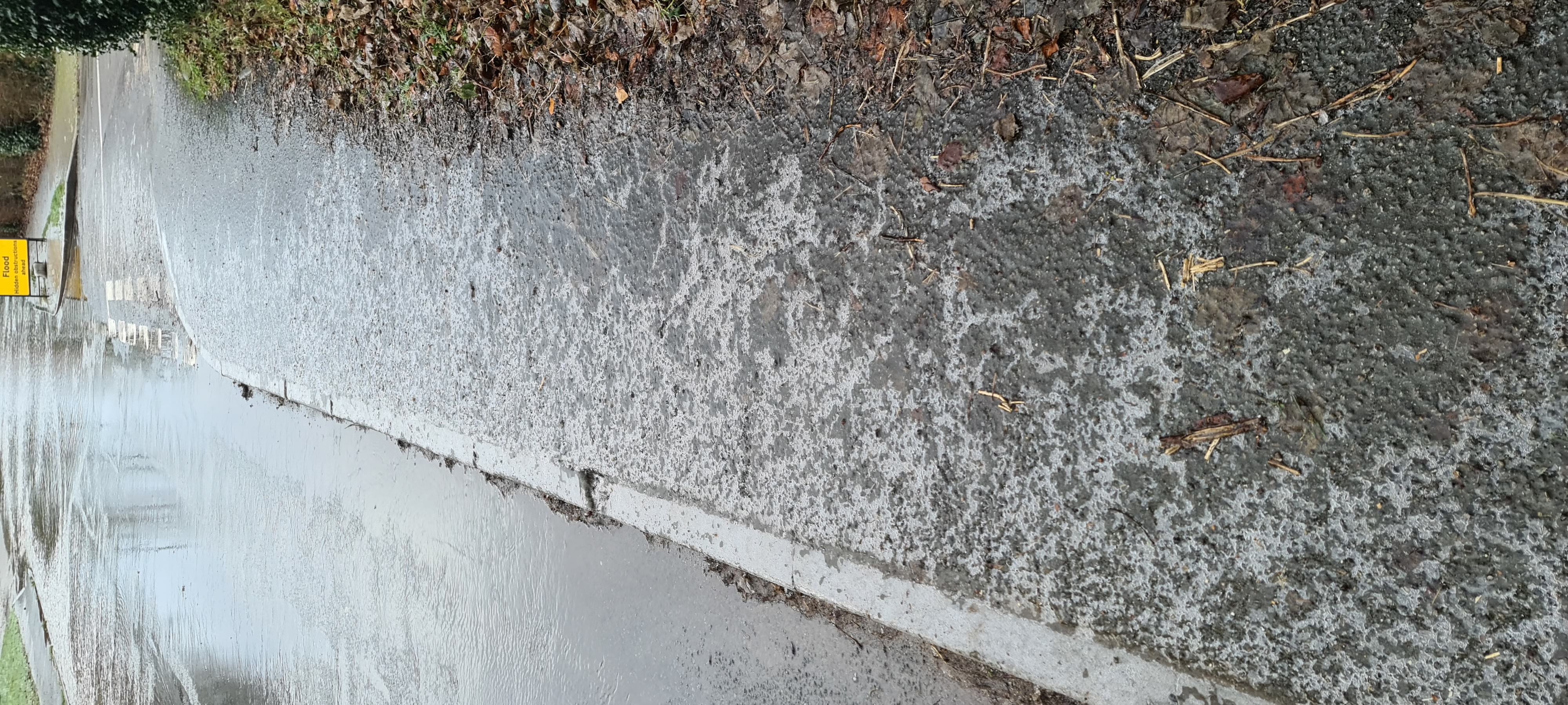
The flooding occured over a short period at the end of January and the beginning of February. This coincided with a very cold snap which resulted in extensive black ice on the pavements in Dean Lane. The black ice was as a result of the backwash from cars freezing. The Parish Council purchased a tonne of Grit from Dorset Council which was then spread along the pavements by volunteers. This had to be repeated over a number of days as the paths froze each day. Black ice also formed on the High Street and Back Lane from the water running off cars exiting the floods.
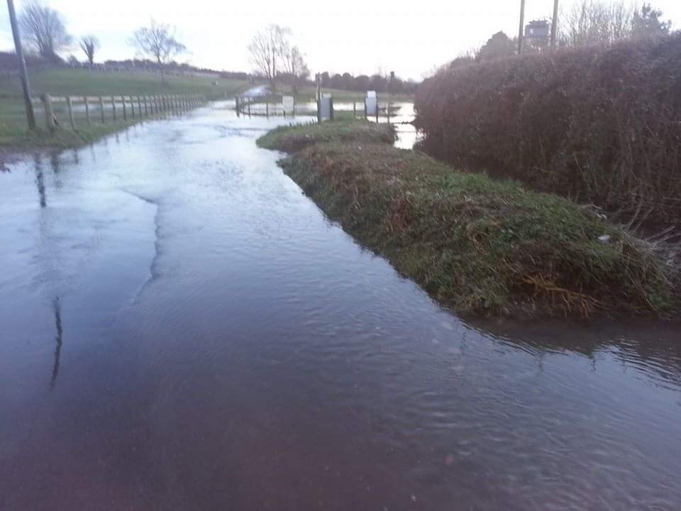
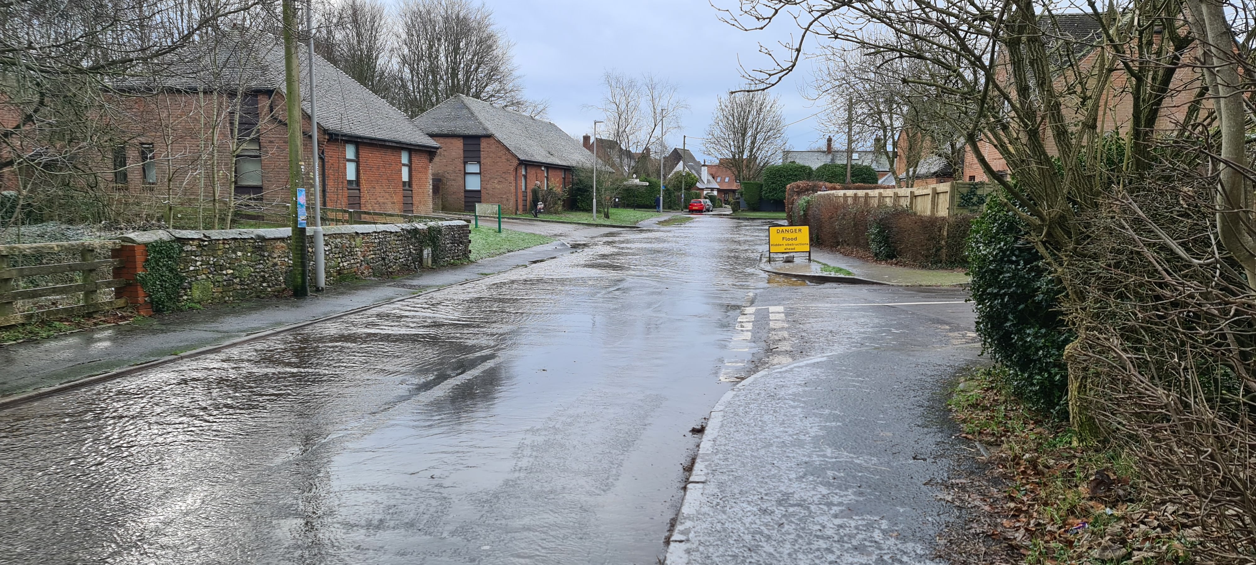
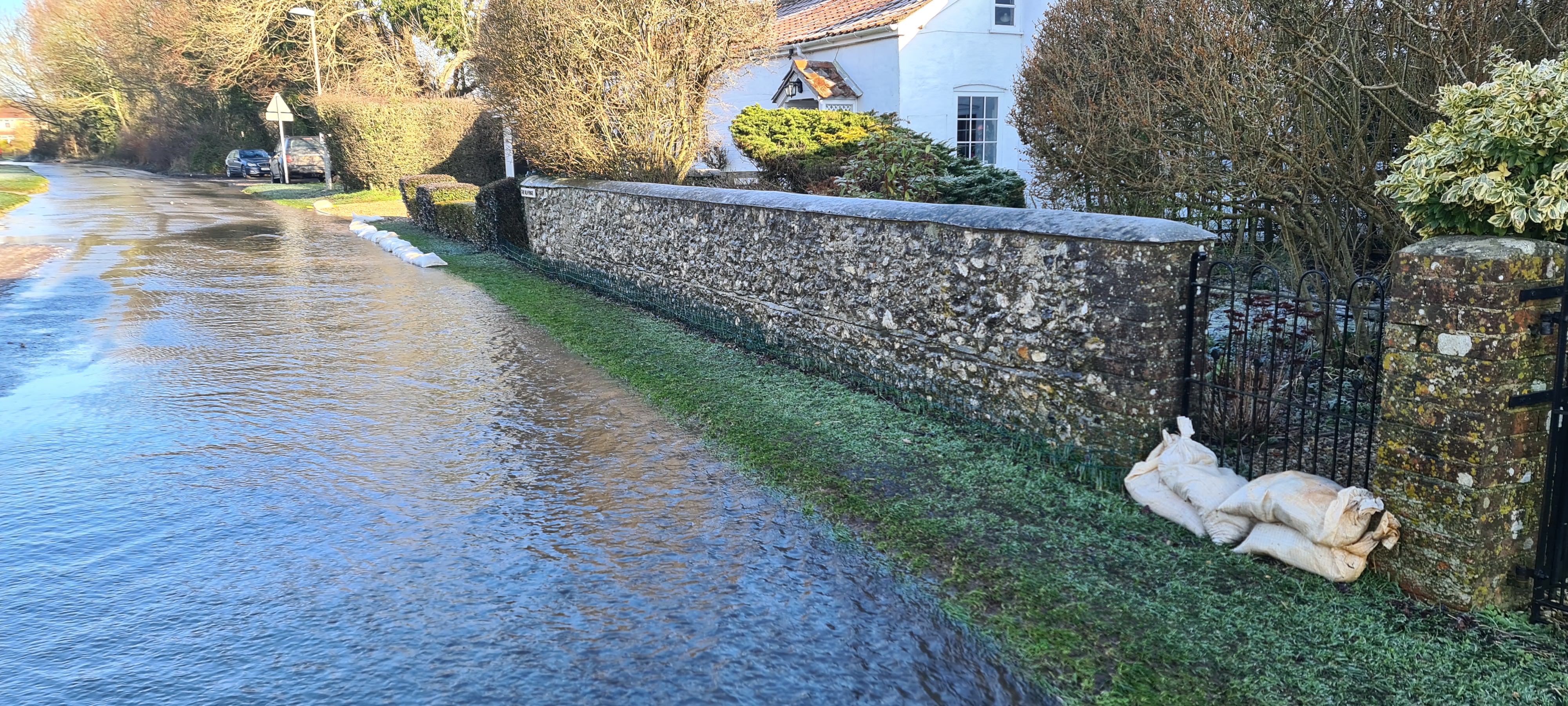
The flood water ran into the gulley on Frogmore Lane, but due to a grip pointing downstream and the ditch in the field being silted up, it ran out onto Frogmore Lane where a 45 cm deep pool formed just before the junction with Back Lane. The water continued down Back Lane forming a large pool in front of Manor Farm.
The flood water also impacted the swewage systems with some of the houses in Paddock Close unable to flush thier downstairs toilets. There were sewage manhole covers leaking in both Dean and Frogmore lanes
Additional signage had to be deployed by Dorset Council at Spots Green (junction with Deanland) to warn drivers of severe potholes on the road to Bower Chalk.
- Impact on Infrastructure post the flooding
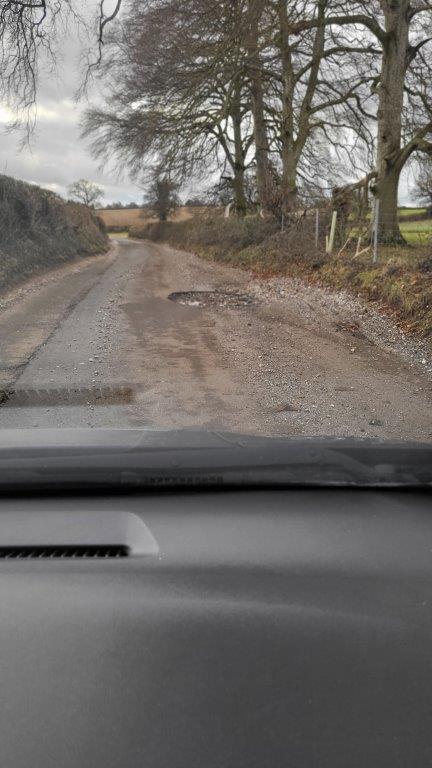
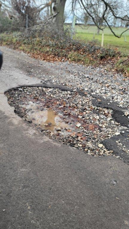
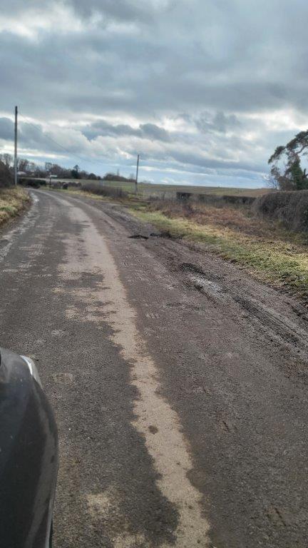
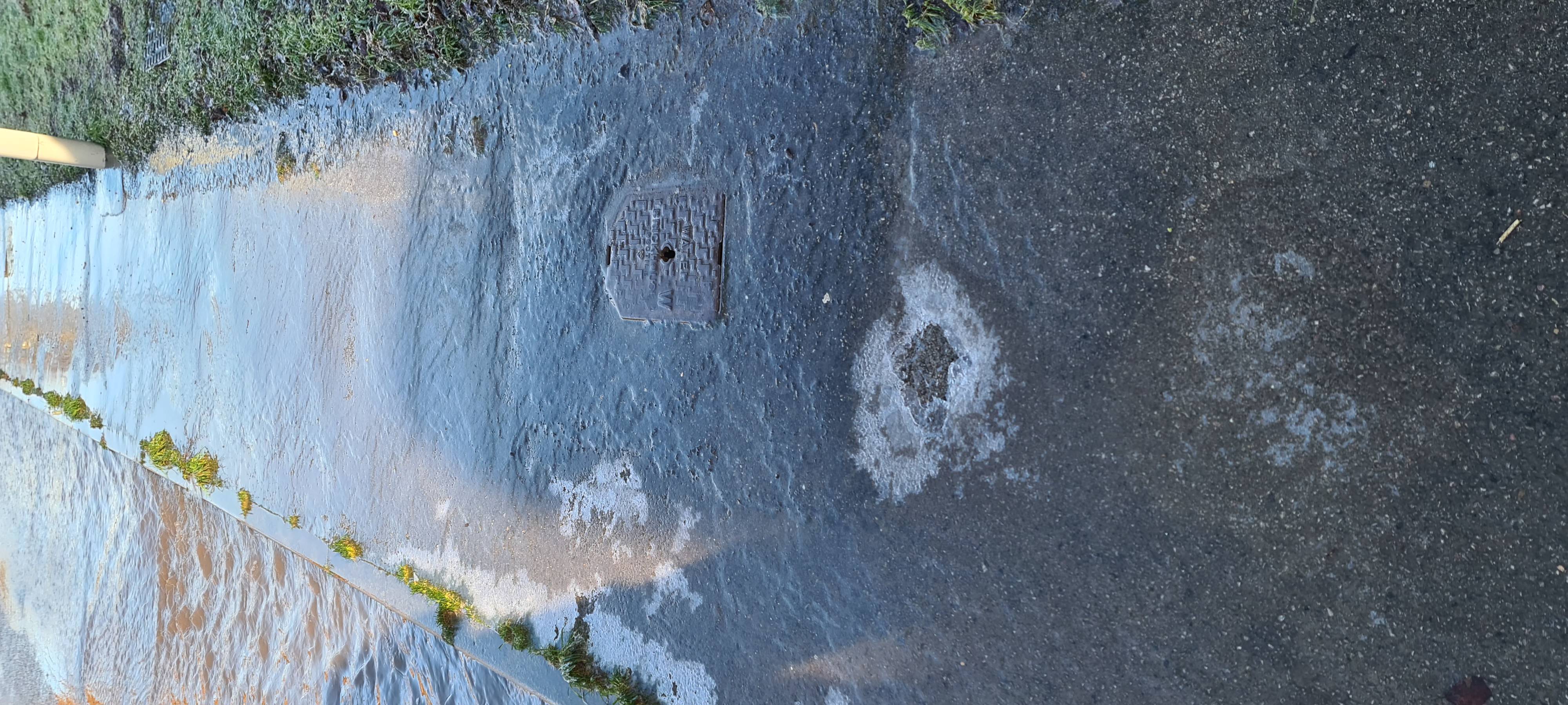
There were many potholes on the road from Garston Wood and in Dean Lane that washed out by the flood water that had to be repaired.
Dorset Council conducted a survey to confirm the road drain routes and subsequently had teh drains from Manor Farm up to the surgery cleaned as silt had blocked them in several places.
A roadsweeper also cleared all side roads and Dean lane of debrie as these were extensive, the pavements ajdacent to the crossroads were also cleared.
The leaking manhole covers and blocked sewers in Paddock Close were reported to Wessex Water.
A report on the flooding and its aftermath was approved by the Parish Council, this resluted in these pages being published so that the reason for flooding and its impact on the parish is better understood going forward. A report of each subsequent flood will be documented. Any household being impacted by a flood should report it on the Flood Online Reporting Tool (FORT) - Here. This builds up a picture of flooding for the Environment Agency, based on this information they can seek funding to provide additional safeguards. If it is not reported it will not get funded.
- Photographs taken during and post the floods
Damage caused by this years flooding between Garston Wood and Dean Lane
| 
| 
|
Flooding in Dean Lane, affected properties utilised thier existing flood protection systems and sandbags
| 
|
|
Black Ice had to be treated on the footpaths along Dean Lane to allow access to the Surgery
| 
| 
|
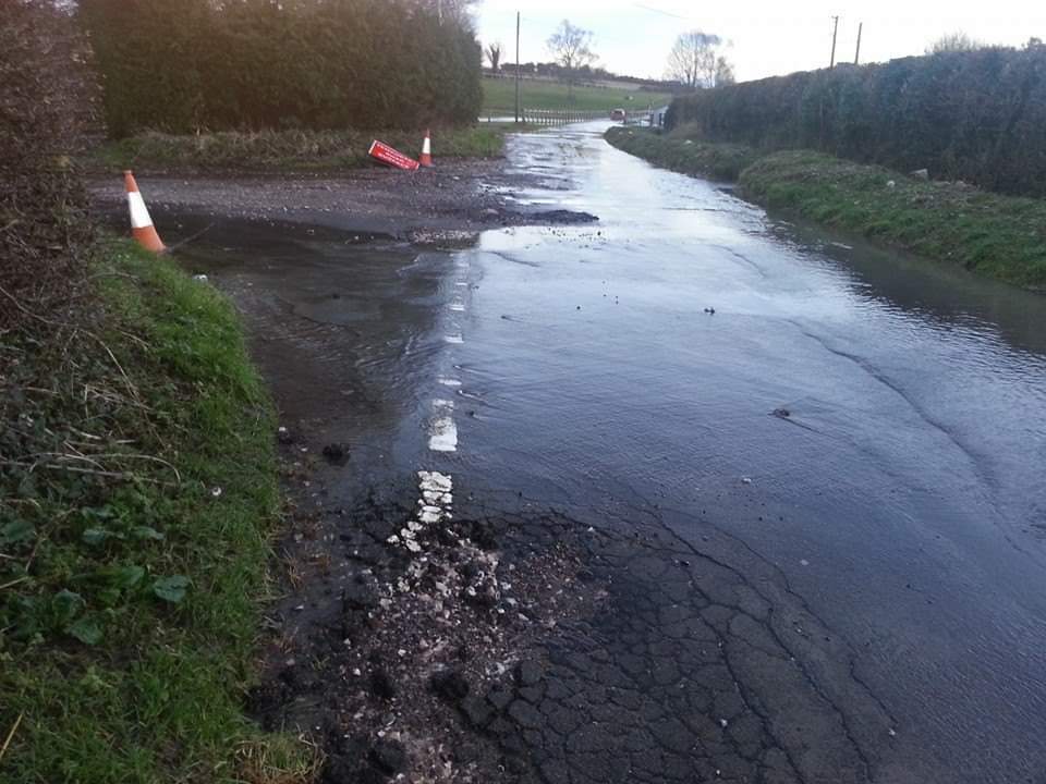
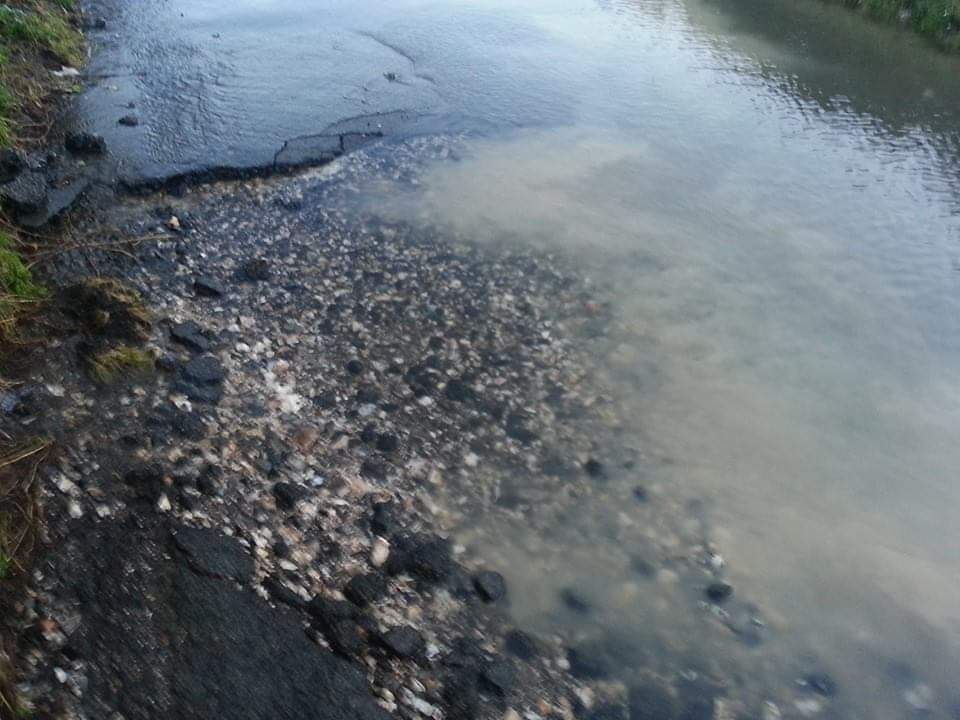
A flash flood in July 2023 showing the 'downstream' grip which enables flood water to flow back onto Frogmore Lane. The gully this is connected to has the surface water drainage pipes from the village as its input.
|
USEFUL LINKS
Environment Agency - Here
Dorset Council - Here
Flood Online Reporting Tool (FORT) - Here
Communities Prepared - Here